LiDAR Mapping. Precision in Every Pulse.
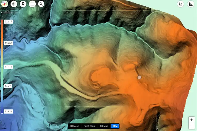
Our LiDAR-equipped drone services deliver sub-centimeter accuracy, providing high-density 3D data for terrain, vegetation, and infrastructure across Sonoma County, Napa County, Marin County, Solano County, Lake County, and Mendocino County.
Drone LiDAR Mapping Services
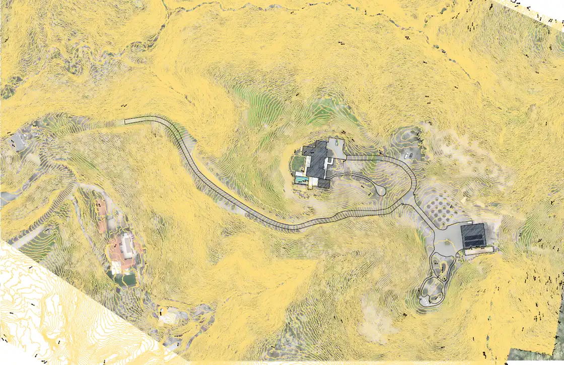
LiDAR mapping with drones captures millions of laser pulses per second, producing detailed 3D point clouds and accurate topographic models. From forestry and environmental monitoring in Mendocino County to corridor and infrastructure mapping in Napa and Solano, our technology delivers clarity where photogrammetry falls short.
High-Density 3D Terrain Models
Generate precise terrain models with LiDAR for construction planning, land development, and environmental analysis throughout Sonoma, Marin, and Lake Counties.
Corridor & Infrastructure Mapping
Map roads, utilities, and railways with LiDAR for long, narrow corridors. Perfect for transportation and civil engineering projects in Napa, Solano, and beyond.
Forestry & Vegetation Analysis
Penetrate dense canopy with LiDAR to measure biomass, tree heights, and vegetation health across Mendocino and Lake Counties.
Sub-Centimeter Structural Data
Capture structural and topographic data at incredible detail, ideal for engineering surveys and floodplain mapping across Sonoma and Marin Counties.
LiDAR Applications for Every Industry
Cyclone Drone Services provides scalable LiDAR solutions that support industries from construction and civil engineering to forestry and urban planning in Sonoma, Napa, Marin, Solano, Lake, and Mendocino Counties.
Topographic Mapping
LiDAR enables precise Digital Surface Models (DSM) and Digital Terrain Models (DTM), ensuring accuracy for planning and permitting.
Urban Planning & Development
From color schemes to typography, we pay meticulous attention to visual elements. We create visually stunning interfaces that not only captivate but also reinforce your brand identity.
Floodplain & Watershed Analysis
Use LiDAR to model drainage, watershed boundaries, and flood risk across Solano, Lake, and Mendocino Counties.
LiDAR Expertise Across Northern California
Explore how our LiDAR mapping services support industries across Sonoma, Napa, Marin, Solano, Lake, and Mendocino Counties. From civil engineering to forestry, our technology ensures unmatched accuracy and actionable data.
1
Surveying & Civil Engineering
- High-resolution terrain data
- Roadway & corridor mapping
- Utility infrastructure modeling
- Sub-centimeter accuracy for design
2
Environmental & Forestry
- Canopy penetration for biomass
- Vegetation health analysis
- Land management surveys
- Forestry inventory mapping
3
Urban Planning & Development
- 3D city models
- Zoning & land use mapping
- Floodplain & watershed analysis
- Smart growth planning
4
Construction & Infrastructure
- Construction progress monitoring
- Earthwork & volume calculations
- Corridor mapping (roads, rail, utilities)
- Bridge & structural inspections
Our LiDAR Mapping Workflow
From flight planning to final deliverables, our LiDAR workflow includes aerial data capture, advanced processing, and quality control—ensuring geo-referenced, industry-standard outputs for projects across Sonoma, Napa, Marin, Solano, Lake, and Mendocino Counties.
A true industry professional and an incredible UAV pilot.
Cyclone Drone Services really delivers on exceptional aerial data and videography needs. If you need a beautiful perspective from the sky, you’ve found the right Drone Service Provider! You will not be disappointed!
Justin Kwong
Local Guide
Posted 2 weeks ago
This company not only has exceptional customer service but they are incredibly passionate and professional about their business.
Highly recommend!!!
Pablo Carballado
Verified Reviewer
Posted 6 months ago
What Our Clients Are Saying About Cyclone Drone Services
See why customers trust Cyclone Drone Services for professional UAV piloting, aerial videography, and data solutions. Here are real reviews from our clients.