Construction Progress Monitoring. From Planning to Completion.
Track construction projects across Sonoma, Napa, Marin, Solano, Lake, and Mendocino Counties with recurring drone surveys, detailed maps, and visual reports that ensure your site stays on schedule.
Drone Monitoring for Construction Progress
We provide recurring aerial imaging, photogrammetry, and drone documentation to track construction progress. Deliverables include annotated maps, 3D site models, progress timelines, and data formatted for BIM and project management workflows.
Aerial Surveys
Recurring high-resolution drone flights for progress documentation.
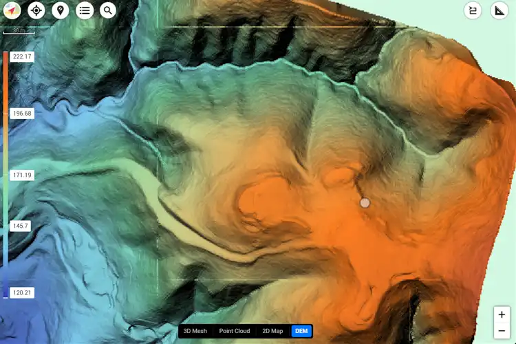
3D Site Models
Generate photogrammetric 3D models for accurate construction monitoring.
Annotated Maps
Detailed maps with annotations for stakeholders, inspectors, and managers.
BIM Integration
Data prepared for seamless integration into BIM and project management systems.
Why Drone Monitoring Matters for Construction
Drone progress monitoring improves communication, enhances reporting, and provides visual comparisons over time. From Sonoma County to Mendocino County, our FAA-certified pilots deliver consistent, reliable documentation for construction teams and investors.
Progress Documentation
Visual comparisons across survey intervals keep all stakeholders informed.
Time-Lapse Insights
Capture construction from groundbreaking to completion with scheduled drone flights.
Regulatory & Client Reports
Produce audit-ready visuals and data to satisfy regulatory requirements and client transparency.
Our Construction Monitoring Capabilities
Explore our comprehensive construction monitoring solutions used across Napa, Sonoma, Marin, Solano, Lake, and Mendocino Counties. Our portfolio demonstrates the impact of aerial documentation on project efficiency and accuracy.
1
Aerial Imaging
- High-resolution progress photos
- Orthomosaic maps
- Time-lapse documentation
2
3D & Mapping
- Photogrammetric 3D site models
- Cut & fill volume tracking
- Surface & terrain mapping
3
Site Reporting
- Annotated progress maps
- Regulatory compliance reports
- Owner & investor updates
4
Integration
- BIM system compatibility
- Project management dashboards
- Data archiving & audit readiness
How Our Drone Monitoring Works
Our drone monitoring process is designed for construction projects of all sizes. From site mobilization in Sonoma County to urban development in Marin County, we provide repeatable aerial surveys, deliverables formatted for project workflows, and data that ensures your team stays on schedule and within budget.
A true industry professional and an incredible UAV pilot.
Cyclone Drone Services really delivers on exceptional aerial data and videography needs. If you need a beautiful perspective from the sky, you’ve found the right Drone Service Provider! You will not be disappointed!
Justin Kwong
Local Guide
Posted 2 weeks ago
This company not only has exceptional customer service but they are incredibly passionate and professional about their business.
Highly recommend!!!
Pablo Carballado
Verified Reviewer
Posted 6 months ago
What Our Clients Are Saying About Cyclone Drone Services
See why customers trust Cyclone Drone Services for professional UAV piloting, aerial videography, and data solutions. Here are real reviews from our clients.