Drone Animal Rescue Support in Sonoma, Napa, Marin, Solano, Lake & Mendocino Counties
Fast, safe, and precise drone thermal imaging to locate missing pets, livestock, or wildlife across Sonoma County, Napa County, Marin County, Solano County, Lake County, and Mendocino County.
Aerial Thermal Drone Support for Animal Rescue
Outfitted with FLIR-certified sensors, our drones deliver high-resolution thermal imagery to assist animal rescue operations in forests, fields, disaster zones, and rural communities across Northern California.
Thermal Imaging for Pets
Quickly detect missing pets hidden in brush, vineyards, or neighborhoods using advanced infrared sensors.
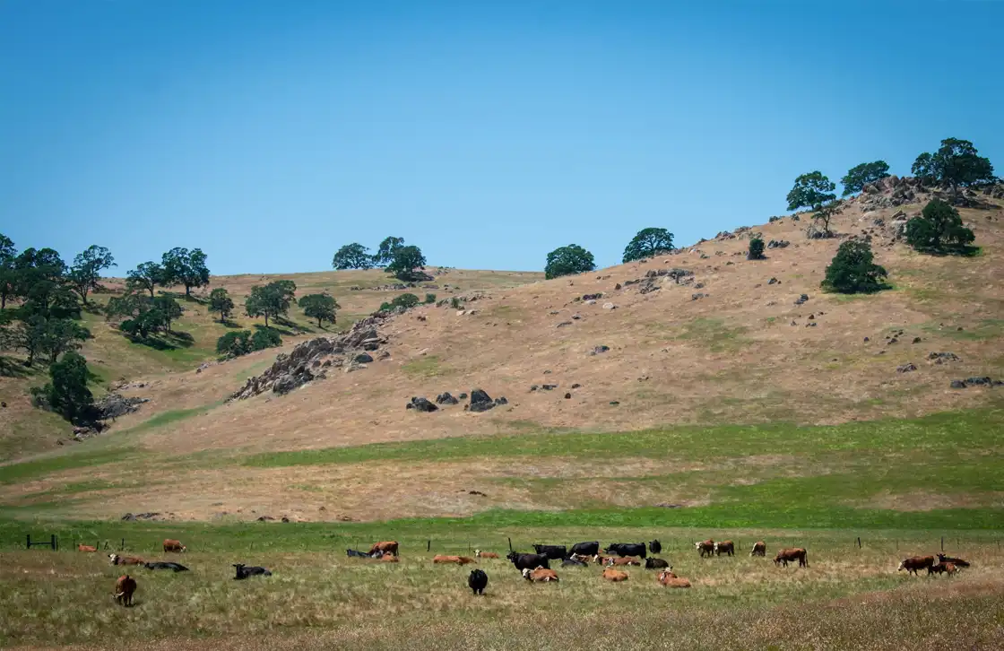
Livestock Recovery
Locate lost or injured livestock across farms and rangelands in Sonoma, Napa, Marin, Solano, Lake, and Mendocino Counties.
Wildlife Location
Track and monitor injured or displaced wildlife in remote areas with thermal and visual imaging.
Disaster Response
Support emergency teams after fires, floods, or earthquakes with aerial thermal reconnaissance.
Precision Drone Thermal Solutions for Rescue Teams
Our FLIR-equipped drones provide clear, actionable data to enhance search and rescue effectiveness. Whether in urban neighborhoods or rugged rural terrain, our technology ensures faster response times.
Rapid Deployment
Our drones can be deployed quickly to cover large search areas, reducing critical response times.
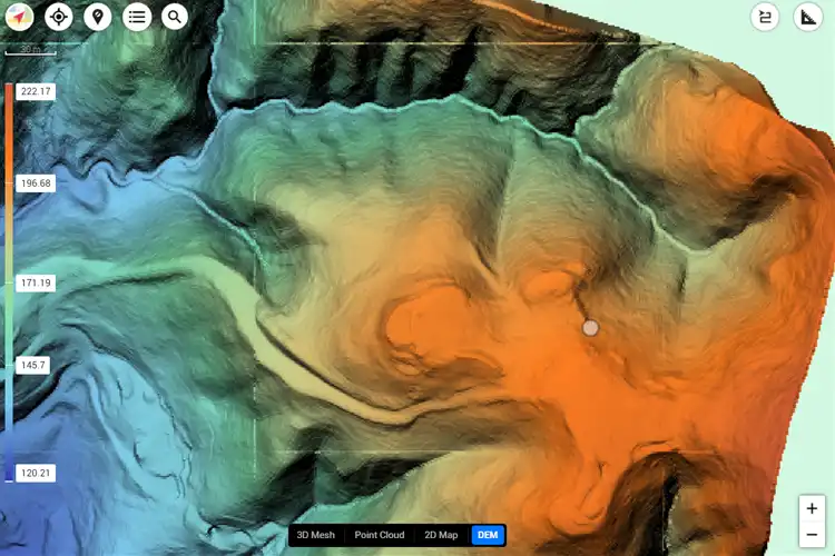
High-Resolution Thermal Maps
Generate detailed infrared imaging maps that pinpoint heat signatures in complex environments.
Versatile Applications
Effective across all terrains and weather conditions — from city blocks to dense forests.
Animal Rescue Support Expertise.
Explore how our drone-based thermal imaging supports animal rescue operations across Northern California, from suburban neighborhoods to remote wilderness areas.
1
Pet Rescue
- Locate missing cats and dogs
- Scan suburban and rural neighborhoods
- Work alongside local shelters and rescue groups
2
Livestock Support
- Track cattle, horses, and farm animals
- Cover vast agricultural properties
- Provide rapid search across difficult terrain
3
Wildlife Location
- Support conservation teams
- Detect injured wildlife
- Map migration corridors
4
Disaster Response
- Aerial reconnaissance in fire-impacted areas
- Flood and earthquake recovery
- Real-time data integration with emergency response systems
How Drone Animal Rescue Support Works
Our team uses thermal-equipped drones to scan targeted areas, identify heat signatures, and provide real-time data to animal rescue teams. From Sonoma to Mendocino County, our process ensures efficient, reliable, and compassionate rescue support.
A true industry professional and an incredible UAV pilot.
Cyclone Drone Services really delivers on exceptional aerial data and videography needs. If you need a beautiful perspective from the sky, you’ve found the right Drone Service Provider! You will not be disappointed!
Justin Kwong
Local Guide
Posted 2 weeks ago
This company not only has exceptional customer service but they are incredibly passionate and professional about their business.
Highly recommend!!!
Pablo Carballado
Verified Reviewer
Posted 6 months ago
What Our Clients Are Saying About Cyclone Drone Services
See why customers trust Cyclone Drone Services for professional UAV piloting, aerial videography, and data solutions. Here are real reviews from our clients.