Accurate Volumetric Calculations. Trusted Results.
Using advanced drone technology, we provide precise volumetric calculations for stockpiles, earthworks, and material inventories across Sonoma, Napa, Marin, Solano, Lake, and Mendocino Counties.
Drone-Based Volumetric Calculations
Leverage drone technology for fast, safe, and highly accurate volumetric data. Our services deliver repeatable, audit-ready results for mining, construction, logistics, and more across Northern California.
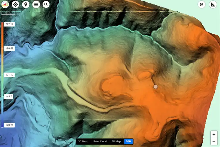
Stockpile Measurement
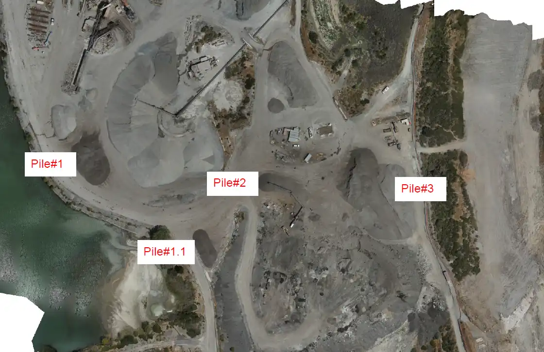
Capture and calculate stockpile volumes with centimeter-level accuracy, ensuring reliable material tracking for mining and construction projects.
Cut-and-Fill Analysis
Analyze earthwork changes and project excavation needs with highly accurate drone-based calculations tailored to your site.
Material Inventory
Generate volumetric reports that support material audits, inventory tracking, and compliance for logistics and industrial operations.
Construction Earthworks
Monitor site changes, validate contractor reports, and ensure accurate billing with drone-based volumetric surveys.
Why Choose Drone Volumetric Surveys?
Our drone surveys eliminate guesswork by producing geo-referenced 3D models and volumetric reports. From Sonoma vineyards to Napa construction projects, our FAA-certified pilots deliver fast, cost-effective, and safe data collection.
Safety & Efficiency
Reduce the need for on-the-ground survey crews with safe, aerial volumetric methods.
Accuracy
Our drone workflows generate centimeter-level precision for stockpile measurement and earthwork analysis.
Scalability
Whether your project is in Marin, Solano, Lake, or Mendocino Counties, our volumetric services scale to fit local industry needs.
Industries We Serve
Our volumetric drone surveys are trusted by industries across Sonoma, Napa, Marin, Solano, Lake, and Mendocino Counties for accurate reporting and project oversight.
1
Mining & Quarrying
- Precise stockpile measurements and production tracking.
2
Construction
- Cut-and-fill analysis, progress tracking, and billing validation.
3
Logistics
- Material inventory management and audit-ready reporting.
4
Agriculture & Land Development
- Volume assessments for soil movement, grading, and vineyard management.
Our Volumetric Survey Process
We capture aerial data with LiDAR and photogrammetry-equipped drones, process the imagery into accurate 3D models, and deliver volumetric reports tailored to your project needs. The result: repeatable, precise, and actionable data.
A true industry professional and an incredible UAV pilot.
Cyclone Drone Services really delivers on exceptional aerial data and videography needs. If you need a beautiful perspective from the sky, you’ve found the right Drone Service Provider! You will not be disappointed!
Justin Kwong
Local Guide
Posted 2 weeks ago
This company not only has exceptional customer service but they are incredibly passionate and professional about their business.
Highly recommend!!!
Pablo Carballado
Verified Reviewer
Posted 6 months ago
What Our Clients Are Saying About Cyclone Drone Services
See why customers trust Cyclone Drone Services for professional UAV piloting, aerial videography, and data solutions. Here are real reviews from our clients.