Lost Dog or Animal? Thermal Drone Search Across the North Bay
When your dog, horse or livestock goes missing, every hour counts. I fly a DJI Matrice 4T thermal drone in a systematic, expanding grid from the last place your animal was seen, covering ground in minutes that would take a search party hours on foot.
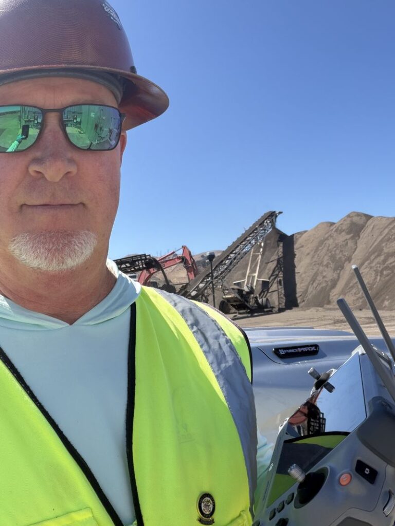
I'm Ian, a Dog Owner Who Knows That Sick Feeling
I’m a dog owner and a lifelong dog lover. I know the panic of an open gate, a slipped collar, or a dog that bolted during fireworks or a storm. Your animal isn’t “just a pet.” They’re family, and you want them home tonight.
I’m Ian Burns, owner of Cyclone Drone Services. I’ve lived in Santa Rosa for more than 28 years, I’m a U.S. Navy and U.S. Army veteran, and I’ve spent 30+ years running construction projects where planning and discipline matter. I bring that same methodical approach to every animal search, along with professional thermal equipment and FAA Part 107 certification.
I can’t promise every search ends with a reunion. I can promise a careful, organized search, an honest update on what I see, and real effort to bring your animal home.
Which Animals I Search For
I search for dogs and larger animals, the ones that move through open ground, brush, vineyards, creek beds and hillsides where an aerial thermal view makes a real difference.
Dogs of All Sizes
Dogs that ran off from home, a trailhead, a car accident or a new home. Scared dogs often hide and won’t come when called, but they still give off a heat signature.
Horses & Livestock
Horses, cattle, goats, sheep, llamas and other livestock that got through a fence or scattered after a fire, flood or storm.
Other Large Animals
Other large domestic animals on rural or open property. Not sure if your situation fits? Call me and we’ll talk it through.
How I Find Your Animal: The Expanding Grid Search
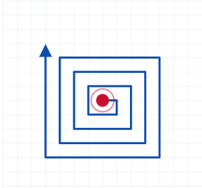
Random flying wastes battery and misses ground. Instead I use an expanding grid search (an expanding square pattern), the same structured method used in professional search and rescue.
1
You call with the last known sighting
Where and when your animal was last seen, which way it was heading, its size, color and temperament, and any recent sightings from neighbors.
2
I plan the search on a map
I set the starting point at the last known sighting and look at terrain, roads, creeks, cover and airspace before I launch.
3
I fly an expanding grid
Starting right at the sighting, I fly outward in a square pattern that gets bigger with each lap. Each pass overlaps the last so nothing gets skipped, and the most likely ground gets searched first.
4
Thermal and zoom together
I scan for heat signatures on the thermal camera, then switch to the zoom camera to confirm whether it’s your animal or a deer, coyote or neighbor’s dog.
5
I guide you in
When I spot a likely match, I give you a precise location and talk you in on foot, keeping the drone at a distance so it doesn’t spook your animal.
The Equipment: DJI Matrice 4T Thermal Drone
I fly the DJI Matrice 4T, a commercial-grade enterprise drone built for search and rescue, public safety and inspection work. This isn’t a hobby camera drone. It carries four cameras, a laser rangefinder and a night-vision light in one gimbal, so I can find, confirm and pinpoint an animal on a single flight.
How the Thermal Camera Finds Animals
The thermal camera doesn’t need light. It sees heat. A dog’s or horse’s body is much warmer than the ground, grass and brush around it, so it shows up as a bright shape on the screen, even in shadows, tall grass, light brush or complete darkness.
The camera uses a 640×512 radiometric sensor (up to 1280×1024 in Super Resolution mode). Radiometric means it measures the actual temperature of what it sees, which helps me tell a warm animal from a sun-heated rock or a patch of asphalt.
Why Timing Matters
Thermal works best when the ground has cooled: early morning, evening and night. On a hot afternoon, sun-baked rocks and dirt can be as warm as an animal, so contrast drops.
Lost animals also tend to move at dawn and dusk and lie still during the day. That makes those cooler hours the best window to search, and the best time to call me.
Matrice 4T at a glance
Thermal camera
640×512 radiometric thermal (1280×1024 Super Resolution), 28x digital zoom
Visual cameras
Three 48 MP cameras: wide, medium telephoto and telephoto, with up to 112x hybrid zoom to confirm an animal from a distance
Laser rangefinder
Measures distance up to 1,800 m and gives the GPS location of what I'm looking at, so I can send you to the exact spot
NIR auxiliary light
Near-infrared light for low-light visual confirmation, not visible to the human eye and far less startling to an animal than a spotlight
Flight time
Up to 49 minutes per battery (manufacturer rating), with spare batteries for continuous searching
What to Do Right Now If Your Animal Is Missing
1. Call me early
The sooner I’m in the air, the smaller the search area. A fresh last-known sighting is the most valuable thing you have.
2. Don't chase
Frightened dogs often run from people, even their owners. Ask neighbors and searchers not to chase or call loudly if they spot your animal.
3. Leave a scent item
Put a worn shirt, bedding and water at the place they were last seen. Report the loss to local animal services, shelters and neighborhood groups.
Frequently Asked Questions
Can a drone really find a lost dog?
Yes, a thermal drone can help. A dog’s body heat shows up clearly against cooler ground, brush and water, especially early in the morning, in the evening and at night. The expanding grid makes sure the area is covered systematically.
Do you search for cats?
No. I search for dogs and larger animals such as horses, goats, sheep, cattle and other livestock. Cats tend to hide inside structures and under decks where a drone can’t see them.
Can you see through trees?
No. Thermal can’t see through solid objects or a dense tree canopy, but it can pick up heat through gaps in the canopy, along edges, and in light brush and tall grass. I plan the grid around the terrain to make the most of that.
Will the drone scare my animal?
The Matrice 4T’s zoom cameras let me watch from a distance and altitude where most animals don’t react. Once I find your animal, I guide you in on foot.
What areas do you cover?
I’m based in Santa Rosa and cover Sonoma, Napa, Marin, Solano, Lake and Mendocino counties.
How much does it cost?
$500 deployment fee for the first 2 hours, including travel within 20 miles. $1.00 per mile round trip beyond 20 miles. $200 per hour after the first 2 hours, with a maximum of 6 hours per day.
Animal Search Pricing
Simple, upfront pricing so you can make a fast decision when it matters.
Deployment Fee
$500
first 2 hoursIncludes travel within a 20-mile radius of Santa Rosa, search planning, and the first 2 hours of searching.
Additional Time
$200
per hour after the first 2Maximum of 6 hours of searching per day.
Extended Travel
$1.00
per mile, round tripFor locations beyond the 20-mile radius.
Example: a full 6-hour search day within 20 miles is $500 + (4 hours × $200) = $1,300.